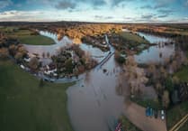
Say goodbye to the fear of a hosepipe ban and hello to flooding!
The Met Office has issued a yellow weather warning today, impacting the south-east of England and the East Midlands from Brighton all the way up to Norwich. Thunderstorms and heavy rain are expected until 3pm today.
The effects of this weather can already be seen, with reports of inundated football pitches and floods seen at Wrecclesham Hill, but the Met Office is predicting more disruption including potential delays to train services, possibly some short-term loss of power as well as longer journey times by car and bus because of bad driving conditions.
The Met Office said: “From the early hours of Thursday, ten to 20mm of rain is likely over quite a large area, but with some embedded thunderstorms some sites are likely to see 30 to 40mm in two to three hours and perhaps 50mm or more over six hours. Lightning will be an additional hazard. The area of rain is expected to ease from the south-west before clearing into the North Sea during Thursday afternoon.”
Flooding occurs in summer with a lower quantity of water than other seasons, as hot weather causes moisture to evaporate from the soil, meaning that when rainfall does come it is unable to percolate into the ground and thus flash flooding is more likely during periods of intense rainfall that only last a short period of time.
Rachel Whitmore


Comments
This article has no comments yet. Be the first to leave a comment.